 |
 |
<< Blog | |||||||||
| |||||||||
As physical AI moves from digital environments into the real world, one capability is becoming increasingly important: 3D world model memory. A 3D world model memory gives physical AI a persistent, spatially grounded representation of its environment. Instead of reacting only to what its sensors see at a particular moment, an AI system can build and maintain an understanding of where objects are, how they are arranged, and how the environment changes over time.
Over the past three to four years, 3D SLAM scanners have made major advances in accuracy, portability, and large-scale mapping. These advances make SLAM point clouds a strong foundation for high-fidelity 3D world models, capturing complex environments - from factories and warehouses to commercial buildings - with precise geometry and a common spatial reference.
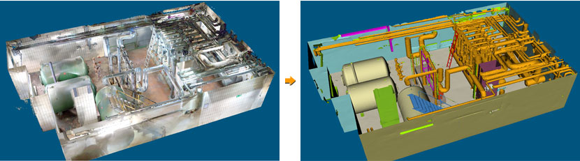
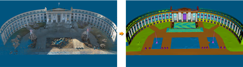
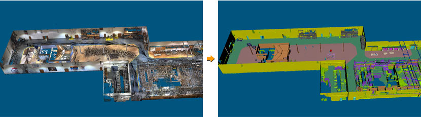
To explore this potential, we tested three datasets captured using NavVis, Emesent, and Exyn SLAM scanners with VRMesh AI. The datasets represent different real-world environments and demonstrate how large-scale SLAM point clouds can be transformed into structured 3D environments through a three-step workflow:
The key opportunity is not simply capturing more 3D points. It is turning those points into structured, machine-understandable environments. SLAM scanners provide the spatial foundation: accurate geometry, large-scale coverage, and a consistent coordinate frame. VRMesh AI can then transform this unorganized geometric information into structured 3D meshes, segmented objects, and multi-layer semantic annotations. This creates a potential pipeline: 3D SLAM Scanning -> Point Clouds -> Meshes -> Segmentation -> Multi-Layer Annotation -> 3D World Model Memory Such a pipeline could provide physical AI systems with a persistent geometric and semantic representation of the environments in which they operate.
A consistent 3D coordinate framework is particularly important as multiple robots begin operating together. When environmental information is represented in a common spatial reference, different robots can potentially share the same 3D world representation rather than maintaining completely independent views of their surroundings. This could support applications such as:
The combination of increasingly capable SLAM scanners and structured 3D annotation could therefore become an important building block for persistent 3D world models. 3D SLAM can provide the geometric foundation. Structured 3D annotation can provide the semantic layer. Together, they can form the foundation for a persistent 3D world model memory.
The VRMesh AI workflow uses a hierarchical, multi-layer 3D mesh annotation schema to transform unorganized geometric data into structured and semantically meaningful 3D environments. This approach connects large-scale 3D scanning with the downstream requirements of physical AI, robotics perception, simulation, and digital twins - helping bridge the gap between raw spatial data and machine-understandable world models.
| |||||||||